Search

Our Child Health Analytics Team uses cutting-edge technologies to better understand how and why the health and wellbeing of children varies from place to place. We develop innovative geospatial methods that can harness large, complex datasets to pinpoint hotspots of elevated risk, evaluate change through time, and explore underlying drivers.


News & Events
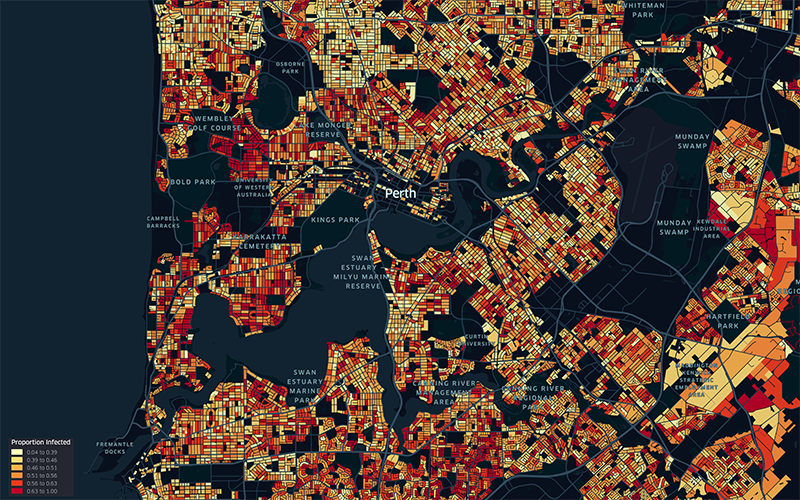
Sophisticated new modelling suggests keeping mask mandate could prevent 147,000 COVID-19 casesWA’s current Omicron COVID-19 outbreak could jump by 147,000 cases if mask mandates are abandoned before the Easter long weekend, according to sophisticated new modelling.

News & Events
New study identifies African ‘hotspot’ for highly infectious diseasesA regional corner of Africa is a hotspot for cases of HIV, tuberculosis and malaria, prompting researchers to call for targeted health support rather than a national response.
Research
A novel statistical framework for exploring the population dynamics and seasonality of mosquito populationsUnderstanding the temporal dynamics of mosquito populations underlying vector-borne disease transmission is key to optimizing control strategies. Many questions remain surrounding the drivers of these dynamics and how they vary between species-questions rarely answerable from individual entomological studies (that typically focus on a single location or species).
Research
Risk factors associated with unsuccessful tuberculosis treatment outcomes in Hunan Province, ChinaGlobally, China has the third highest number of tuberculosis (TB) cases despite high rates (85.6%) of effective treatment coverage. Identifying risk factors associated with unsuccessful treatment outcomes is an important component of maximising the efficacy of TB control programmes.
Research
A fractional land use change model for ecological applicationsBy mapping land use under projections of socio-economic change, ecological changes can be predicted to inform conservation decision-making. We present a land use model that enables the fine-scale mapping of land use change under future scenarios. Its predictions can be used as input to virtually all existing spatially-explicit ecological models.
Research
Inequalities in excess premature mortality in England during the COVID-19 pandemic: A cross-sectional analysis of cumulative excess mortality by area deprivation and ethnicityTo examine magnitude of the impact of the COVID-19 pandemic on inequalities in premature mortality in England by deprivation and ethnicity.
Research
The prevalence of tuberculosis and malaria in minority indigenous populations of South- East Asia and the Western Pacific Region: a systematic review and meta-analysisInfectious diseases have been shown to disproportionately affect indigenous populations. Tuberculosis (TB) and malaria continue to impose a significant burden on humanity and are among the infectious diseases targeted within the 2030 Agenda for Sustainable Development.
Research
Global, regional, and national mortality among young people aged 10–24 years, 1950–2019: a systematic analysis for the Global Burden of Disease Study 2019Documentation of patterns and long-term trends in mortality in young people, which reflect huge changes in demographic and social determinants of adolescent health, enables identification of global investment priorities for this age group. We aimed to analyse data on the number of deaths, years of life lost, and mortality rates by sex and age group in people aged 10-24 years in 204 countries and territories from 1950 to 2019 by use of estimates from the Global Burden of Diseases, Injuries, and Risk Factors Study (GBD) 2019.
